Port Macquarie Coastal Geotrail
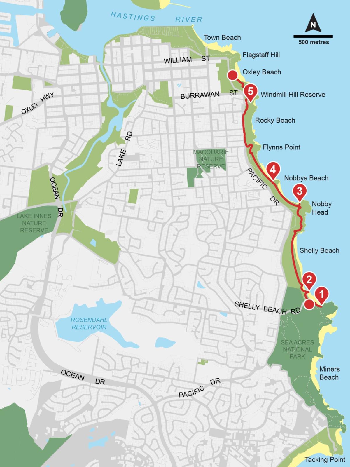
The Port Macquarie Coastal Geotrail is a 4 km walk along the coast from Shelly Beach to Rocky Beach that tells the story of plate tectonics and how Earth’s crust was formed.
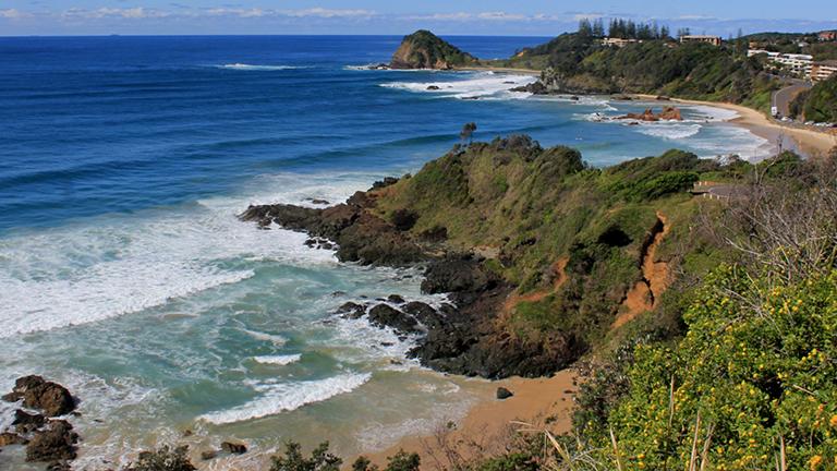
The geotrail features rocks formed by volcanoes, microscopic marine animals, ocean currents, and extreme temperatures and pressures up to 100 km below Earth’s surface.
This collaborative project was led by the University of Newcastle with significant input from the Geological Survey of NSW and the National Parks and Wildlife Service.
NSW GeoTours app
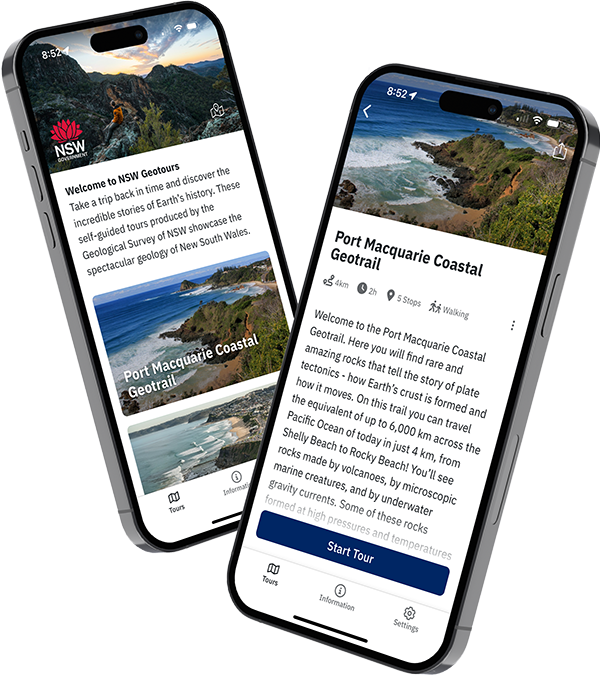
Explore the Port Macquarie Coastal Geotrail with the free NSW GeoTours app on your smartphone or tablet (Apple and Android). Remember to download the tour before you go.
Key points of interest have been geotagged to pop up when you reach a site. The app uses your device’s GPS to locate you even with limited or no network access.
NSW GeoTours is optimised for mobile devices, but can also be accessed on a web browser.
Geotrail brochure
In addition to the app, we also have a folded brochure to guide you on the geotrail. The brochure contains a map of the geotrail and detailed information about each stop, including photos and figures.
Pick up a free copy from Sea Acres Rainforest Centre, the Greater Port Macquarie Visitor Information Centre, or the Department of Primary Industries and Regional Development at 516 High Street, Maitland, or download the brochure (PDF, 4.74 MB) from our website.
Explore online in 3D
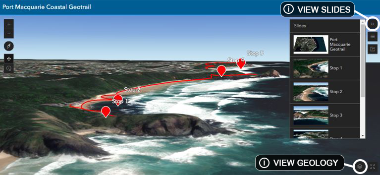
Take an interactive tour in 3D
Features include:
- Predefined views for each stop using the ‘slides’ feature
- Geology data can be added from the ‘layer list’
- Click on the stops to reveal information about the geology along the coastal geotrail.
Accessibility
The Port Macquarie Coastal Geotrail is accessible by foot or by vehicle.
Travel in the same direction as the oceanic plate moved, from Sea Acres to Town Beach, or go in reverse.