Warrumbungle National Park Geotrail
The Warrumbungle National Park Geotrail provides an interactive adventure for visitors to this scenic park, explaining its many spectacular and iconic volcanic features.
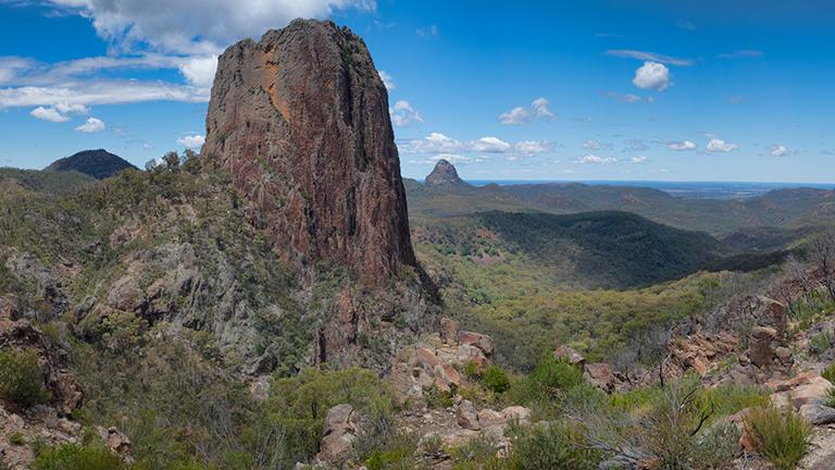
To investigate the eroded remnants of Warrumbungle Volcano that erupted between 15 and 18 million years ago, 5 geotrails follow existing walking tracks and roads to explore the prominent peaks of the park.
Visitors will learn about why the volcano is there, its eruption history and how big it grew. They’ll see evidence of huge lava flows, destructive mud flows and exploding lava domes! The rocks also reveal what was there before the volcano.
This collaborative geotrail project is led by the Geological Survey of NSW with support from NSW National Parks and Wildlife Service, local Aboriginal traditional owners and the Warrumbungle National Park Environmental Education Centre. To find out more about this exciting experience, watch the Warrumbungle National Park Geotrail video:
NSW GeoTours app
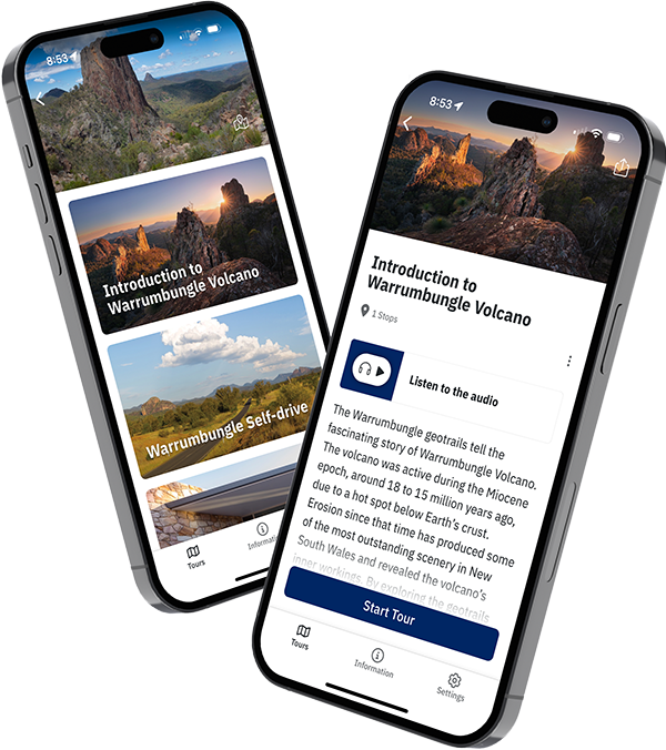
Explore the Warrumbungle National Park Geotrail with the free NSW GeoTours app on your smartphone or tablet (Apple and Android). Be sure to download tours before you go as network access may be limited in the area.
Key points of interest have been geotagged to pop up when you reach a site. The app uses your device’s GPS to locate you even with limited or no network access.
There are 5 tours to download, plus an introduction:
- Introduction to Warrumbungle Volvano (an overview of the geotrail and the geology)
- Warrumbungle Self-drive (22 stops from east to west across the park)
- Central Valley (11 stops including Warrumbungle Visitor Centre, Camp Blackman and Wambelong Nature Track)
- Belougery Split Rock (follows the 4.6 km walking track around the lava dome)
- Grand High Tops Circuit (follows the 14.5 km walking track to the Breadknife and Lughs Throne at the summit of the Grand High Tops)
- Mount Exmouth Geotrail (follows the 17 km walking track to the highest point in the national park).
NSW GeoTours is optimised for mobile devices, but can also be accessed on a web browser.
Geotrail brochure
In addition to the app, we also have a folded brochure to guide you on the geotrail. The brochure contains maps and detailed information about the tours, including photos and figures.
Pick up a free copy from the Warrumbungle Visitor Centre, the Coonabarabran Visitor Information Centre or the Department of Primary Industries and Regional Development at 516 High Street, Maitland, or download the brochure from our website.
Accessibility
Three of the Warrumbungle National Park tours follow existing walking tracks. Another tour links 3 close areas in the heart of the volcano that you can walk or drive between. One driving tour of 40 km links stops close to the road.
Further information
- Geology of Warrumbungle National Park 1:50,000 map – Shop Regional ($11 hardcopy) or DIGS (free download)
- NSW Government geotrail unveils Warrumbungle's violent volcanic past
- Heading to the Warrumbungles? Follow this amazing trail
- Geological Society of Australia Geotourism and Geotrails
- Visit NSW – Warrumbungles & surrounds